Quadricentennial Challenge | |
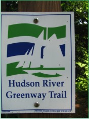 Catskills Live! Trails & Wilderness Association issues a challenge to all — venture forth and seek all 15 Quadricentennial Challenge geocaches. Go to many great places throughout Ulster County — visit the shores of the Hudson, feel the cool air in an historic cement mine, enjoy our small parks, ride on our rail trails, summit two Catskill peaks, and savor the breath-taking view from Gertrude's Nose in Minnewaska State Park Preserve. Bask in our county's treasures with family and friends, exercise your body, and build lasting memories. Specially minted commemorative Quadricentennial geocoins are being released from Challenge geocaches in celebration of the 400th anniversary of the exploration of New York State by Henry Hudson. All 15 Challenge caches will be available this summer. Funding for the Challenge was provided by Ulster County and the Hudson River Valley Greenway. | |
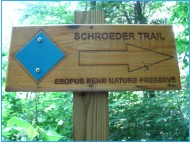
Esopus Bend Nature Preserve | |
The Esopus Bend Nature Preserve is located along the Esopus Creek in Saugerties in northeastern Ulster County, New York State. This 161-acre preserve is owned and managed by the Esopus Creek Conservancy. | 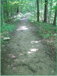 |
| | |
 Its impressive trail network encompasses woodland trails along the Esopus Creek and local tributaries, traverses through former farmlands, boasts a sweet-smelling hemlock forest, enjoys flowering lowland meadows, and revels in the song of spring peepers alongside State wetlands — thus offering a wide variety of rich ecosystems. | |
| | |
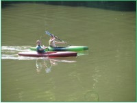 The Preserve's website provides great information and an excellent map depicting the Preserve's trails, including Schroeder (1.2 miles), South, Meadow, East, and Wetlands. In addition to the land trails present in the Preserve, the adjacent Esopus Creek is used by kayakers, canoeists, motor boaters, and anglers. | |
| | |
 The Esopus Creek Conservancy actively promotes nature study and outdoor recreation. They host numerous guided activities including tree walks, bird watching, wildlife observation walks, butterfly walks, mushroom walks, animal tracking workshops, and kayak and canoe tours. | |
| | |
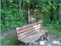
You can also enjoy artwork mounted along preserve trails! | 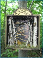 |
| | |
The Bend | |
| | |
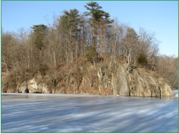
The Esopus Bend Nature Preserve is named after the prominent right-angled bend the creek takes here, changing its flow direction from north-northwest to eastward. The bend is located two miles upstream of the eastern terminus of a deltaic tidal flat the projects far into the Hudson River. | 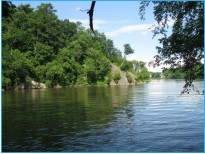 |
| | |
 | Prior to the bend, starting at Glenerie Falls, the creek follows and parallels a combination of the resistant, quartz-rich, Glenerie Formation and Port Ewen through Helderberg Group shale-rich and purer carbonate beds. The bend occurs where the Esopus Creek has, after 3.6 miles, finally managed to carve a route through steeply upturned Helderberg Group geologic beds on its way to the softer shale-rich beds of the Austin Glen Formation the surround and underlie the Hudson River here. |
| | |
The Esopus Creek watershed encompasses hundreds of square miles and includes runoff from 21 mountains towering over 3000 feet above sea level. It is not difficult to imagine the vast stream power present during times of flooding. Visit in spring when the Ashokan Reservoir is spilling for a most impressive sight. | 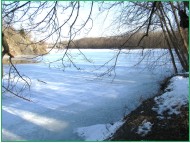 |
| | |
The Carriage Road and Ferry Crossing | |
| | |
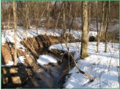
 | Part of the Schroeder Trail follows an historic carriage road down to the Esopus Creek. In the early 1800s, horse-drawn carriages from Glasco followed this route to a scow ferry at Stony Point until the first bridge was constructed across the Esopus, possibly in the 1830s. |
| | |
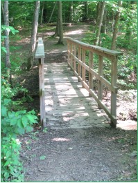
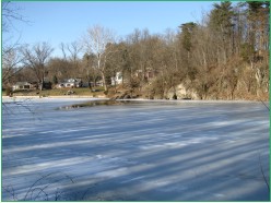
Once across, carriages and their riders proceeded up the hill slope depicted on the accompanying photo to Saugerties. Today, wagon wheel ruts cut into bedrock to facilitate boarding and disembarking the ferry may still be seen on the north side of the Esopus. Vernon Benjamin and Steve Chorvas kindly provided this information. | 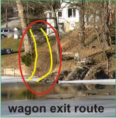 |
| | |
As you enjoy the Schroeder Trail, take the time to reflect on both the means of transportation available in the early years of our nation and on the time required to get from point to point. During these early times, our waterways provided important transportation and trade corridors. Consider how far Henry Hudson sailed before he ventured up the Hudson River and the time required to return to his homeland. Consider, also, the exponential change in the region and world that has occurred between the first two hundred years following Hudson's river voyage and carriage crossings across the Esopus Creek here in 1809 and the last two hundred years. | 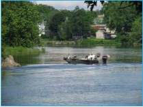 |
| | |
Preserve Trails and a Step Back in Time | |
| | |
Be sure to explore all the trails of the Esopus Bend Nature Preserve. Enjoy the wildlife, the flowers, wetlands, meandering tributaries, meadows, woodlands, and endless flow of the Esopus. Catch a glimpse of the foxes. Look for the spotted spring fawn. Smell the flowers. Listen for the kingfisher. Keep your eyes open for unusual features. Try to picture how the landscape has changed from farming some four decades ago and how it is now reverting back to forest land. | 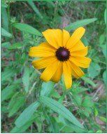 |
| | |
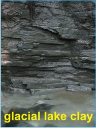 | Look for clues of changes that have occurred over longer time periods. For example, look for layered gray clays along the stream bank as you hike the South Trail. These clays were deposited deep in former Glacial Lake Albany that had a maximum elevation of about 305 feet above mean sea level. The gray color tells us that there was little oxygen at the bottom of the lake. Imagine ice bergs floating far above your head and imagine the lake draining about 14,000 years ago. |
| | |
 | Now picture vast forests rising from the former lake bottom. Drift downstream two miles and envision uninterrupted forests teaming with game. It is now 1609 — look out on the Hudson River, see the fish jumping and the lone Half Moon with sails to the wind. Imagine an untamed continent, loaded with natural resources. |
| | |
In this, you see the prospect of future trade, settlement, and financial venture that Henry Hudson contemplated 400 years ago. | 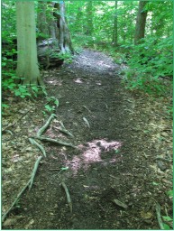 |
| | |
The Cache | |
| | |
 | The cache is located close to an historic earthen Carriage Road that led to the ferry crossing over the Esopus Creek. |
| | |
The cache consists of a 2-liter cylindrical poly bottle filled with kid-friendly items and, initially, four NYS Quadricentennial Challenge geocoins designed to travel throughout the world. Placement of this geocache was approved by the Esopus Creek Conservancy. | 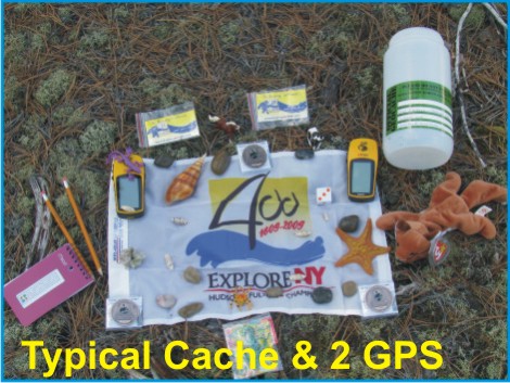 |
| | |
Parking | |
| | |
| From the Village of Saugerties after crossing the Esopus Creek bridge traveling south on 9W, make a right onto Overbaugh Street, then make a left onto Simmons Drive, a right onto Appletree Drive, and a left onto Shady Lane. There is a parking area here that can accommodate a few cars. Look for the Esopus Creek Conservancy kiosk. The Esopus Bend Nature Preserve is open from dawn to dusk. Geocaching is not permitted after dusk. Dogs are allowed, but they must be leashed and their waste bagged and removed. Be sure to say hello to and thank Steve Chorvas should you see him out maintaining the trails. | |
| | |
Please Cache In and Trash Out! | |