|
Quadricentennial Challenge
Catskills Live! Trails & Wilderness Association issues a challenge to all —
venture forth and seek all 15 Quadricentennial Challenge geocaches. Go to many great places
throughout Ulster County — visit the shores of the Hudson, feel the cool air in an historic
cement mine, enjoy our small parks, ride on our rail trails, summit two Catskill peaks, and savor
the breath-taking view from Gertrude's Nose in Minnewaska State Park Preserve. Bask in our county's
treasures with family and friends, exercise your body, and build lasting memories. Specially minted
commemorative Quadricentennial geocoins are being released from Challenge geocaches in celebration of
the 400th anniversary of the exploration of New York State by Henry Hudson. All 15 Challenge caches will be available this summer. Funding for the Challenge was provided by Ulster
County and the Hudson River Valley Greenway.
Hudson Valley Rail Trail — Tony Williams Park
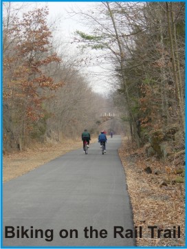 A 2.3 mile section of the Hudson Valley Rail Trail is highlighted by Catskills Live! as part of the New York
Quadricentennial Celebration. This section of paved rail trail is frequented by bicyclists, walkers, roller bladers,
joggers, and birders. This almost level segment of former rail bed is well-suited for strollers and wheelchairs.
Eventually, this rail trail segment will be linked with the Walkway over the Hudson, thus connecting rail trails, parks,
and communities on both sides of the Hudson River.
A 2.3 mile section of the Hudson Valley Rail Trail is highlighted by Catskills Live! as part of the New York
Quadricentennial Celebration. This section of paved rail trail is frequented by bicyclists, walkers, roller bladers,
joggers, and birders. This almost level segment of former rail bed is well-suited for strollers and wheelchairs.
Eventually, this rail trail segment will be linked with the Walkway over the Hudson, thus connecting rail trails, parks,
and communities on both sides of the Hudson River.
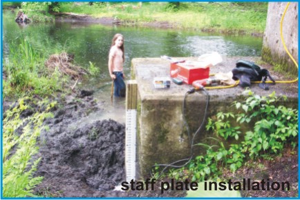
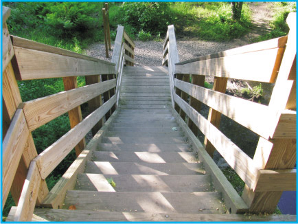 A series of wooden steps along the rail trail provides public access
down to the Black Creek, a unique waterway in eastern Ulster County. The steps, observation decks, and staff plate in the
Black Creek, as well as interpretive material, were funded by a Hudson River Estuary Grant. Some of the interpretive material
that was developed is shared here.
A series of wooden steps along the rail trail provides public access
down to the Black Creek, a unique waterway in eastern Ulster County. The steps, observation decks, and staff plate in the
Black Creek, as well as interpretive material, were funded by a Hudson River Estuary Grant. Some of the interpretive material
that was developed is shared here.
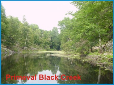
John Burroughs, the Black Creek Wetlands, and Animal Species
 The famous naturalist John Burroughs followed in Henry Hudson's footsteps, opening the Black Creek watershed to the world,
reveling in its wild character — large portions of which remain much as they were long ago. Four important factors
combine to make the Black Creek exceptional: bedrock bounded channel segments that impound expansive wetlands, an
abundance of wildlife species in largely undisturbed habitat, its beautiful natural setting, and limited development.
These are the qualities that attracted John Burroughs to live beside the Black Creek and write his celebrated books
seeking the preservation of nature.
The famous naturalist John Burroughs followed in Henry Hudson's footsteps, opening the Black Creek watershed to the world,
reveling in its wild character — large portions of which remain much as they were long ago. Four important factors
combine to make the Black Creek exceptional: bedrock bounded channel segments that impound expansive wetlands, an
abundance of wildlife species in largely undisturbed habitat, its beautiful natural setting, and limited development.
These are the qualities that attracted John Burroughs to live beside the Black Creek and write his celebrated books
seeking the preservation of nature.
 The Black Creek and its many beautiful wetlands team with numerous animal and plant species, including reptiles,
amphibians, birds, some 25 species of native fish, and macro-invertebrates. The Black Creek and the adjacent Swarte Kill
support the highest herpetofaunal species richness in the Lower Hudson Valley Region.
The Black Creek and its many beautiful wetlands team with numerous animal and plant species, including reptiles,
amphibians, birds, some 25 species of native fish, and macro-invertebrates. The Black Creek and the adjacent Swarte Kill
support the highest herpetofaunal species richness in the Lower Hudson Valley Region.
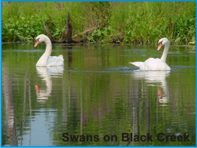
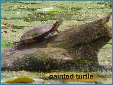
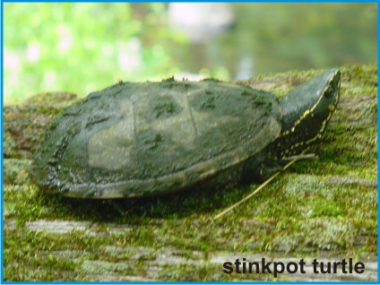 Some of the most interesting wildlife species include the river otter, beaver, swan, warblers, assorted turtles, and the Northern Cricket Frog. Common
fish of the upper reaches include pickerel, herring, bullhead, sunfish, bluegill, largemouth bass, black crappie, perch,
pike, and brown trout, while the lower reaches in direct contact with the Hudson River sometimes sport shad, striped bass,
and sturgeon. It is likely that, first the Native Americans, then Henry Hudson and his crew, and later John Burroughs dined on some of
these fish species.
Some of the most interesting wildlife species include the river otter, beaver, swan, warblers, assorted turtles, and the Northern Cricket Frog. Common
fish of the upper reaches include pickerel, herring, bullhead, sunfish, bluegill, largemouth bass, black crappie, perch,
pike, and brown trout, while the lower reaches in direct contact with the Hudson River sometimes sport shad, striped bass,
and sturgeon. It is likely that, first the Native Americans, then Henry Hudson and his crew, and later John Burroughs dined on some of
these fish species.
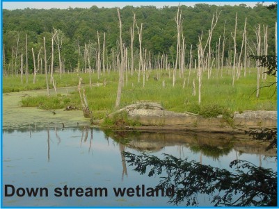
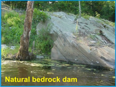 It is the deformed bedrock geology along the Black Creek that has backed stream water up into vast wetlands that support
one of the richest reptile and amphibian populations in New York State. In large part, this results from the gentle
gradient along much of the creek's corridor being punctuated by upturned geologic beds that form natural dams.
It is the deformed bedrock geology along the Black Creek that has backed stream water up into vast wetlands that support
one of the richest reptile and amphibian populations in New York State. In large part, this results from the gentle
gradient along much of the creek's corridor being punctuated by upturned geologic beds that form natural dams.
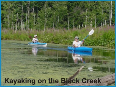 The wetlands these dams impound are frequented by canoeists, kayakers, and fishermen. Some 11 waterfalls, to 25 feet in
height, separate many of the elongate wetlands present along the Black Creek. Historically, two of these waterfalls were
used to power gristmills.
The wetlands these dams impound are frequented by canoeists, kayakers, and fishermen. Some 11 waterfalls, to 25 feet in
height, separate many of the elongate wetlands present along the Black Creek. Historically, two of these waterfalls were
used to power gristmills.
Black Creek Watershed and Flow
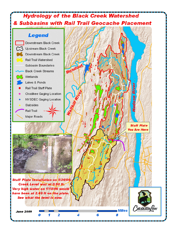
 A sizable portion of eastern Ulster County near the Hudson River comprises the 34 square mile Black Creek watershed. The
watershed area upstream of the rail trail is 15.8 square miles in aerial extent. The Black Creek watershed extends into
the towns of Esopus, New Paltz, Lloyd, and Marlborough and includes numerous preserved, publicly accessible sanctuaries
with trails and waterways well-suited to hiking and canoeing.
A sizable portion of eastern Ulster County near the Hudson River comprises the 34 square mile Black Creek watershed. The
watershed area upstream of the rail trail is 15.8 square miles in aerial extent. The Black Creek watershed extends into
the towns of Esopus, New Paltz, Lloyd, and Marlborough and includes numerous preserved, publicly accessible sanctuaries
with trails and waterways well-suited to hiking and canoeing.
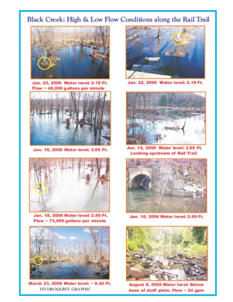
 The reach of the Black Creek accessible from the Hudson Valley Rail Trail has a very gentle gradient and a wide
floodplain. As a result, the range in stream height from low flow to flood conditions is only on the order of several
feet. Measurements made near the base of the wooden steps along the rail trail revealed flows ranging from 24,000 to
73,000 gallons per minute.
The reach of the Black Creek accessible from the Hudson Valley Rail Trail has a very gentle gradient and a wide
floodplain. As a result, the range in stream height from low flow to flood conditions is only on the order of several
feet. Measurements made near the base of the wooden steps along the rail trail revealed flows ranging from 24,000 to
73,000 gallons per minute.
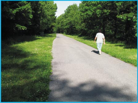
 Look closely at these photos to get a feel for the variable stream conditions here along the
rail trail. Go to the base of the steps and observe the water level on the staff plate and compare it with the levels and
flows illustrated in the photos.
Look closely at these photos to get a feel for the variable stream conditions here along the
rail trail. Go to the base of the steps and observe the water level on the staff plate and compare it with the levels and
flows illustrated in the photos.
The Cache
 Access to the cache is from Tony Williams Park off South Riverside Road or, alternately, from a second parking area
somewhat to the northeast along the same road. The cache is a 2-liter cylindrical poly bottle hidden close to the rail
trail and the wooden steps that provide access to the Black Creek.
Access to the cache is from Tony Williams Park off South Riverside Road or, alternately, from a second parking area
somewhat to the northeast along the same road. The cache is a 2-liter cylindrical poly bottle hidden close to the rail
trail and the wooden steps that provide access to the Black Creek.
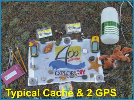 The cache is filled with kid-friendly items and,
initially, three NYS Quadricentennial Challenge geocoins designed to travel throughout the world. This geocache was
approved by Town Supervisor Ray Costantino.
The cache is filled with kid-friendly items and,
initially, three NYS Quadricentennial Challenge geocoins designed to travel throughout the world. This geocache was
approved by Town Supervisor Ray Costantino.
Parking
Parking is at Tony Williams Park in Lloyd, off South Riverside Road.
Please Cache In and Trash Out!
|