Quadricentennial Challenge
Catskills Live! Trails & Wilderness Association issues a challenge to all — venture forth and seek all 15 Quadricentennial Challenge geocaches. Go to many great places throughout Ulster County — visit the shores of the Hudson, feel the cool air in an historic cement mine, enjoy our small parks, ride on our rail trails, summit two Catskill peaks, and savor the breath-taking view from Gertrude's Nose in Minnewaska State Park Preserve. Bask in our county's treasures with family and friends, exercise your body, and build lasting memories.
 Specially minted commemorative Quadricentennial geocoins are being released from Challenge geocaches in celebration of the 400th anniversary of the exploration of New York State by Henry Hudson. All 15 Challenge caches will be available this fall. Funding for the Challenge was provided by Ulster County and the Hudson River Valley Greenway.
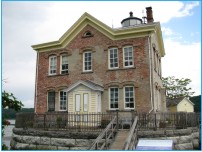
Saugerties Lighthouse & Ruth Reynolds Glunt Nature Preserve
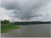
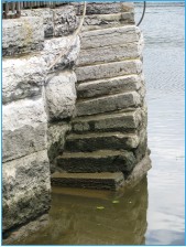
The Saugerties Lighthouse and Ruth Reynolds Glunt Nature Preserve are located along the Hudson River in Saugerties, in northeastern Ulster County, New York State. This exceptional 17-acre preserve is owned and maintained by the Saugerties Lighthouse Conservancy. It affords visitors with a superb view of the Hudson River from an artificial sand bar and lighthouse that project far out into the river.
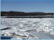
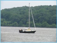
The red brick lighthouse may well be situated within a stone's throw of the actual pathway of Henry Hudson's Half Moon. Here, you can see the Hudson stretching north and south much as it looked 400 years ago. Look out at the river and imagine the river's banks with no buildings, draped with century-old trees. Picture the native Delaware or Lenape peoples (locally referred to as the Esopus after the name of their village) gazing at the full sails of the Half Moon from their villages, wondering about the strange ship and its mission. Soon, Dutch settlers would follow and trade would blossom — especially the beaver fur trade.
As the Hudson River became more and more important for shipping and trade, lighthouses were erected to avoid disasters in shallow river reaches.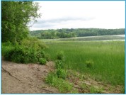
The original Saugerties Lighthouse was built in 1838 and was rebuilt in 1869 in its current charming form. It is likely that the lighthouse was built to steer ships away from the shallow submerged delta (Washburn Point) that formed at the mouth of the expansive Esopus Creek that deposits its sediment load here from the Catskill high peaks. This delta was dredged in 1888 and 1889 to make a deep channel for ship access to Saugerties harbor.
The nature preserve trails are supported by a sandbar comprised of these dredged sediments.
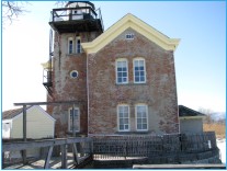
The web site of the Saugerties Lighthouse Conservancy provides additional information, including a link to make overnight reservations to stay in the lighthouse's bed and breakfast inn. Ruth Reynolds Glunt was instrumental in gaining protection of the lighthouse, in part, through getting it placed on the National Registry of Historic Places.
Public viewing of the interior of the lighthouse is available from Memorial Day through Labor Day on weekends from noon to 3:00 pm, or by appointment. This exceptional lighthouse and its extraordinary river vistas clearly warrant its inclusion on a future Hudson River Legacy Trail.
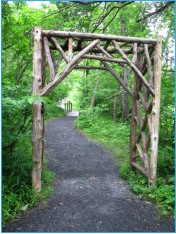
The nature trail, lighthouse area, and tidal flats are particularly well-suited for bird watching, wildlife observation, reflection, boat watching, and hiking. Some of the plant species present are invasive, such as the tall reeds called Phragmites and the sharp, black seeds of the Eurasian water chestnut.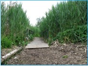
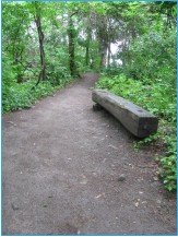
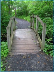
Boardwalks are present along portions of the trail.
Please read these paragraphs carefully:
The cache is located approximately 60 feet off the nature trail that leads to the Saugerties Lighthouse. Because the Ruth Reynolds Glunt Nature Preserve trail is, at times, completely covered by the Hudson River, a degree of creativity was needed to place the cache such that it was likely to remain available. Most of the route to the cache is via a hard-packed trail. A short diversion is needed from the trail to reach the cache.
Be sure not to head in to the cache location until you see your GPS direction arrow point perpendicular to the nature trail. To minimize the need for random cache hunting, the constructed cache container is well illustrated within this geocache write-up! Access via land entails a nearly level round-trip hike of about 1 mile. Portions of the trail flood at high tide so please be sure to consult local tide tables when planning your geocaching trip.
The Cache
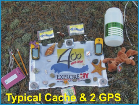
The cache consists of a 2-liter cylindrical poly bottle filled with kid-friendly items and, initially, four NYS Quadricentennial Challenge geocoins designed to travel throughout the world. The real treasures here are the scenic views of the Hudson River, the historic lighthouse, protected freshwater tidal wetlands, and the peaceful setting steeped in time. This geocache was approved by the Saugerties Lighthouse Conservancy.
Parking
This geocache is located approximately two miles due east of NYS Quadricentennial Challenge — Esopus Bend Nature Preserve. A parking area is accessed from Lighthouse Drive, which is situated on the north side of the Esopus Creek in Saugerties. The Preserve is open year-round, from sunrise to sunset. Geocaching is not permitted after sunset.
Please Cache In and Trash Out!